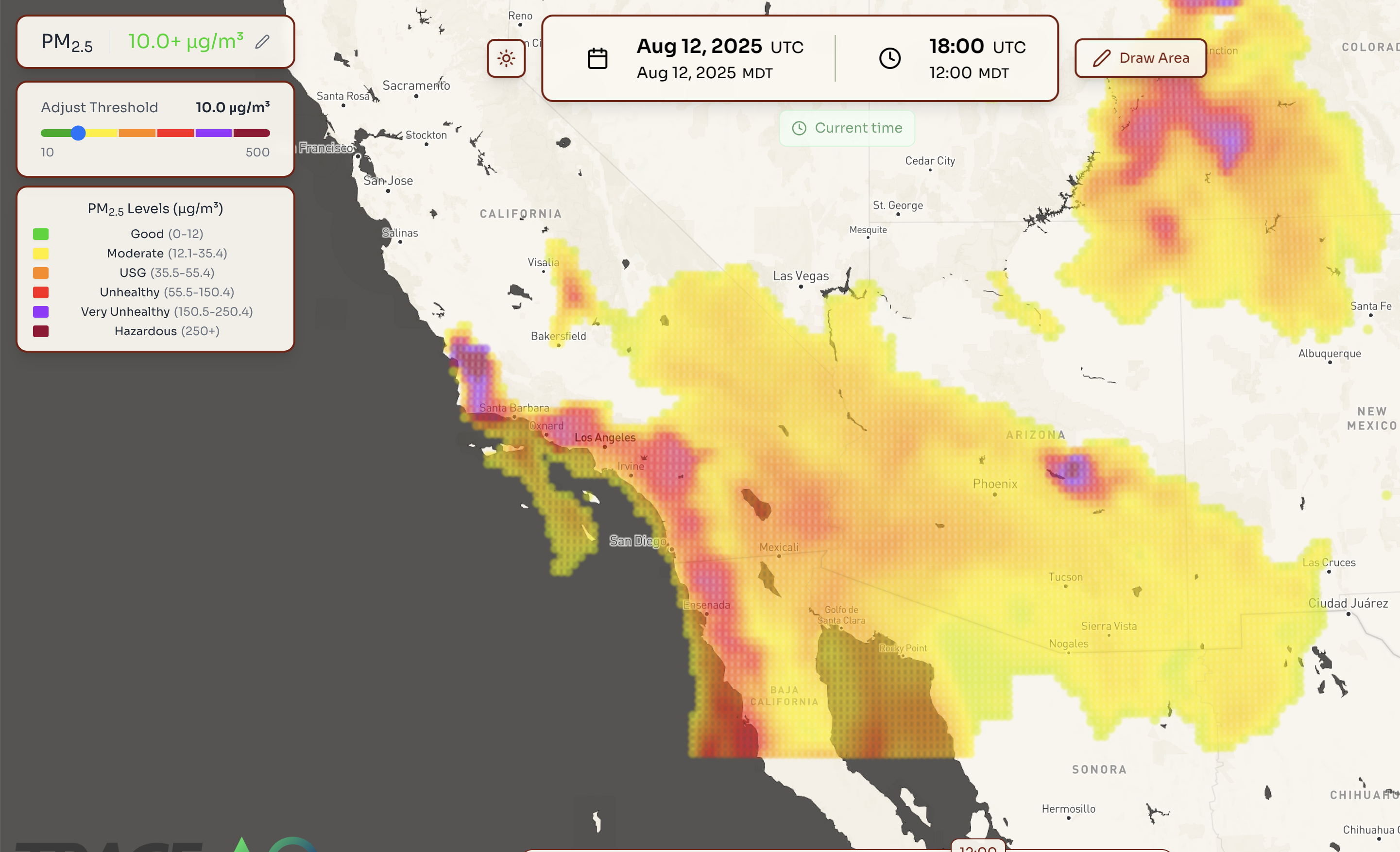
Wildfire Smoke Forecast Tool
Access real-time forecasts and visualization of wildfire smoke patterns and air quality impacts.
View Tool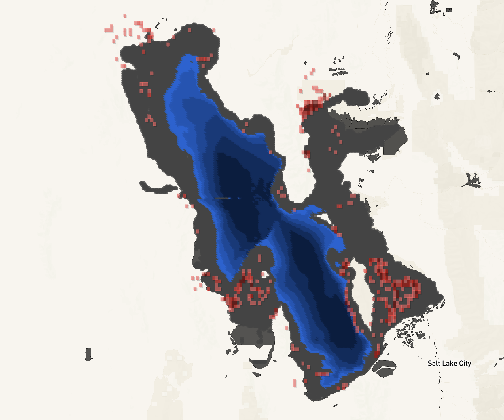
Great Salt Lake Dust Exposure Modeling Tool
Visualize dust exposure patterns from the Great Salt Lake at various Lake levels.
View Tool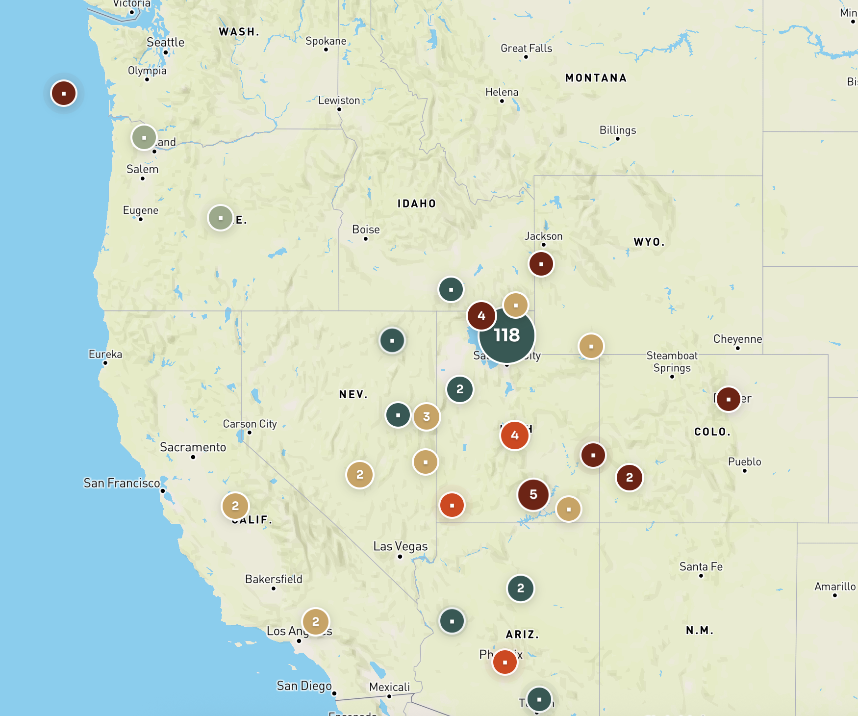
Wilkes Research Focus Map
Displays geographic research focus areas for Wilkes sponsored research.
View Tool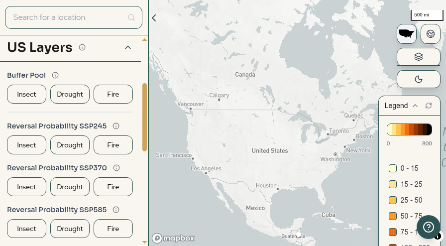
US Carbon Reversal Risk Tool
Visualizes the 100-year carbon reversal risk of forests under different disturbances and severity scenarios.
View Tool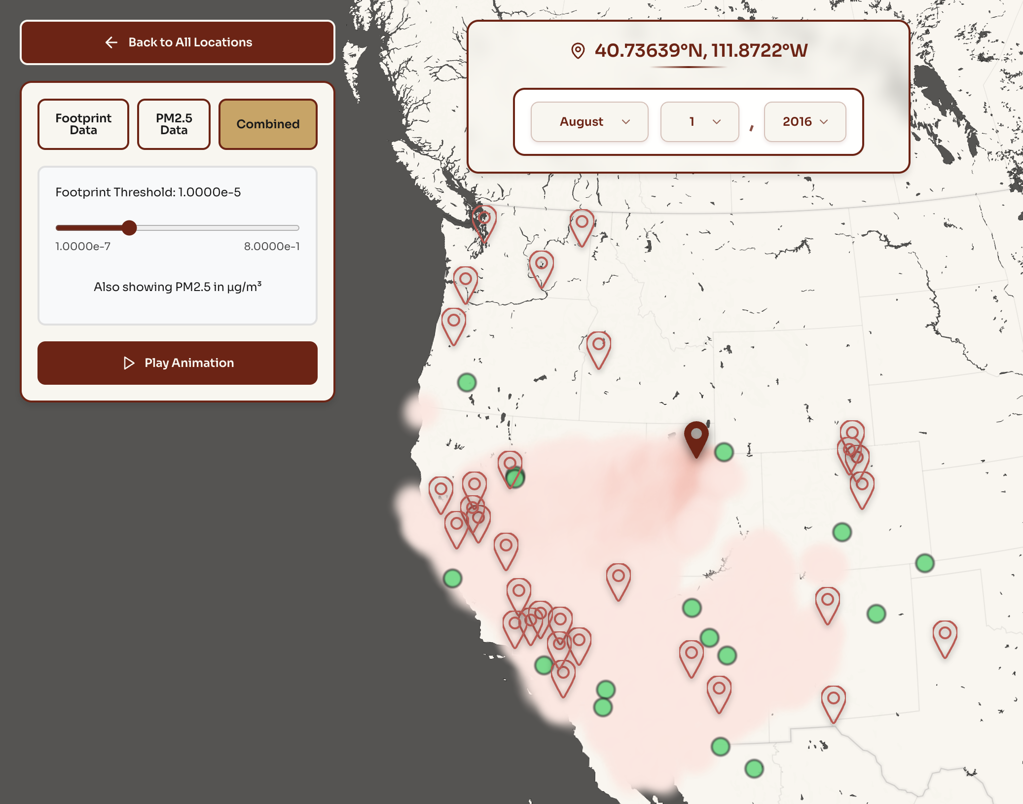
Wildfire Source Regions
Displays historic wildfire footprints to track and analyze fire patterns and their impact over time.
View Tool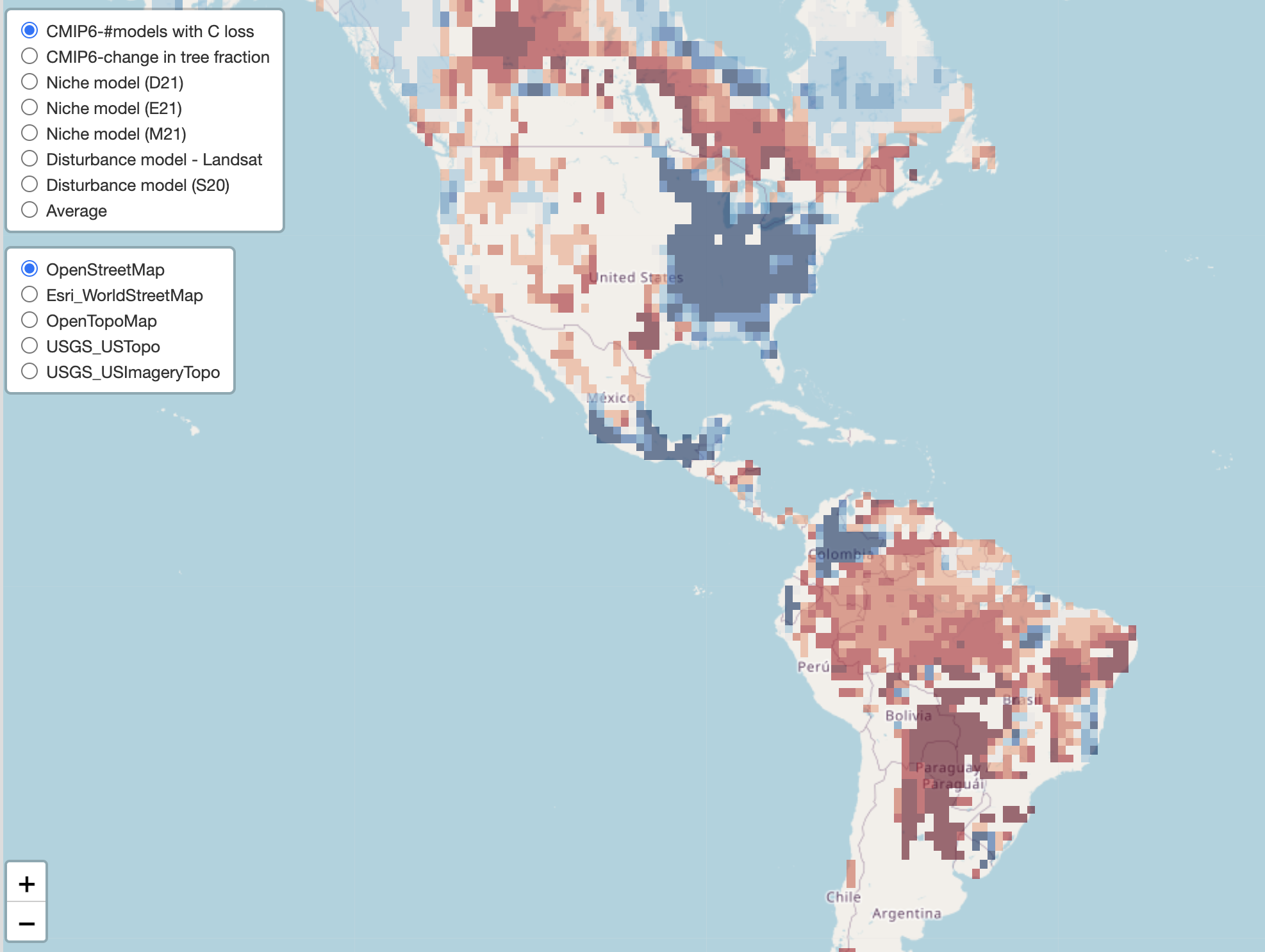
Global Forest Climate Risk Modeling
Interactive tool showing carbon storage potential in forests in the US.
View Tool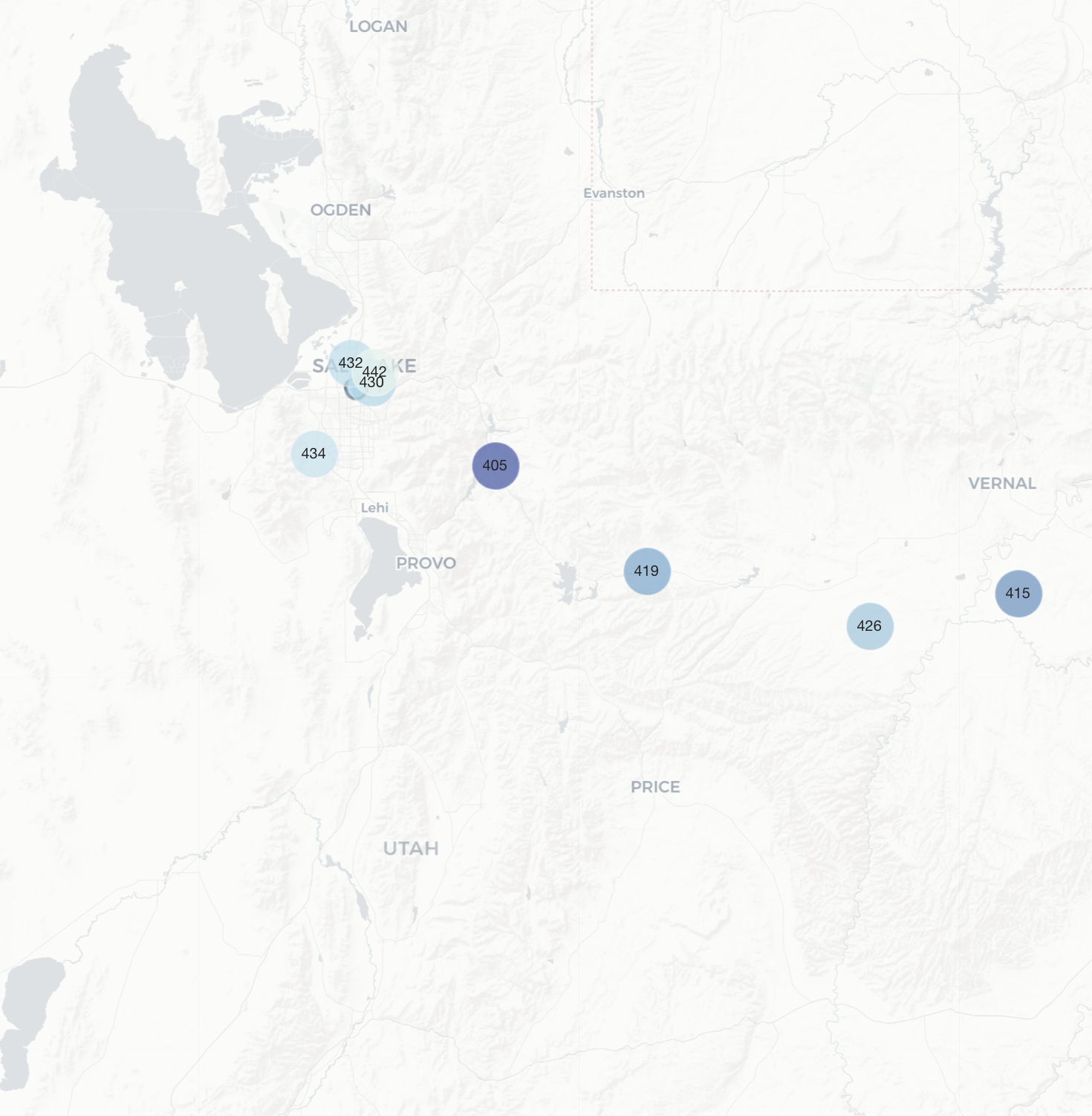
Utah Greenhouse Gas Monitoring Tool
Provides real-time data on CO2 and methane emissions at strategic monitoring sites across northern and eastern Utah.
View Tool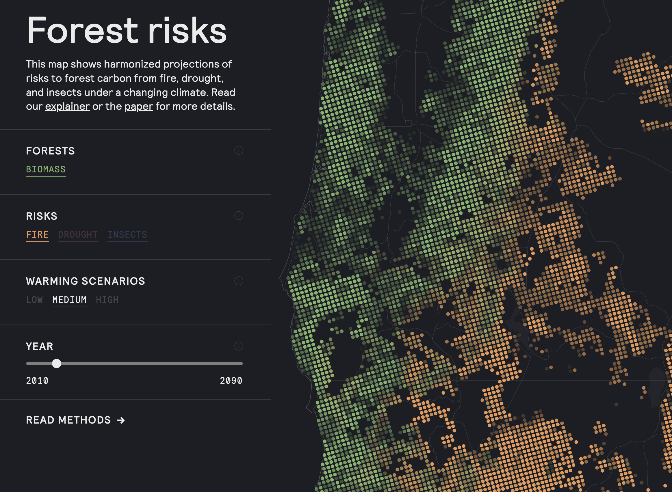
High-resolution US Forest Risks Modeling Tool
This map shows harmonized projections of risks to forest carbon from fire, drought, and insects under a changing climate.
View Tool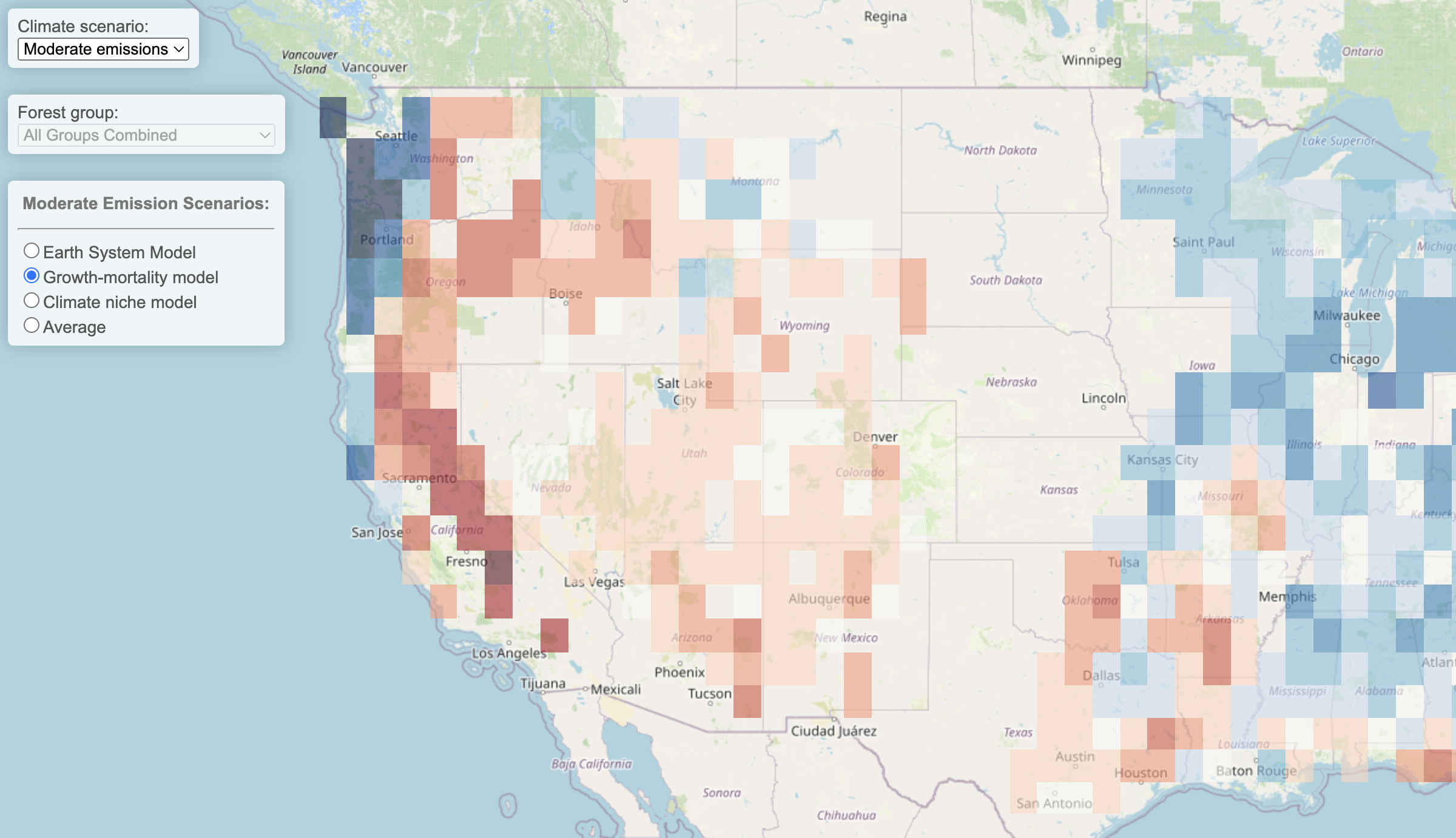
US Forest Carbon Futures Modeling Tool
Projects the relative risk to Earth's forests globally during the 21st century based on multiple approaches, datasets, and climate change scenarios.
View Tool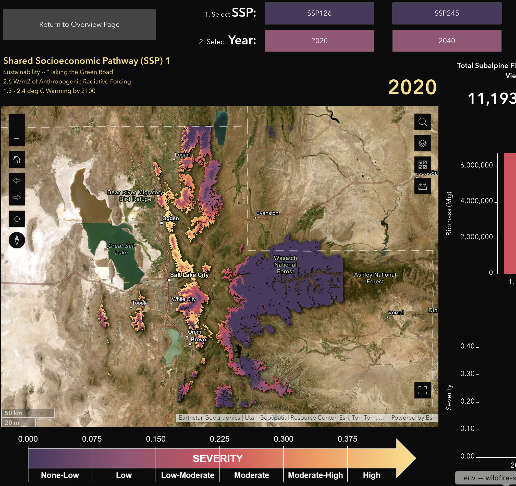
Balsam Woolly Adelgid Monitoring Tool
Maps current and future exposure to climate-facilitated balsam woolly adelgid damage to subalpine fir trees in Northern Utah.
View Tool
2026 Wilkes Climate Innovation Prize
Interactive map displaying applicant locations from around the world for the 2026 Wilkes Center Climate Innovation Prize.
View Tool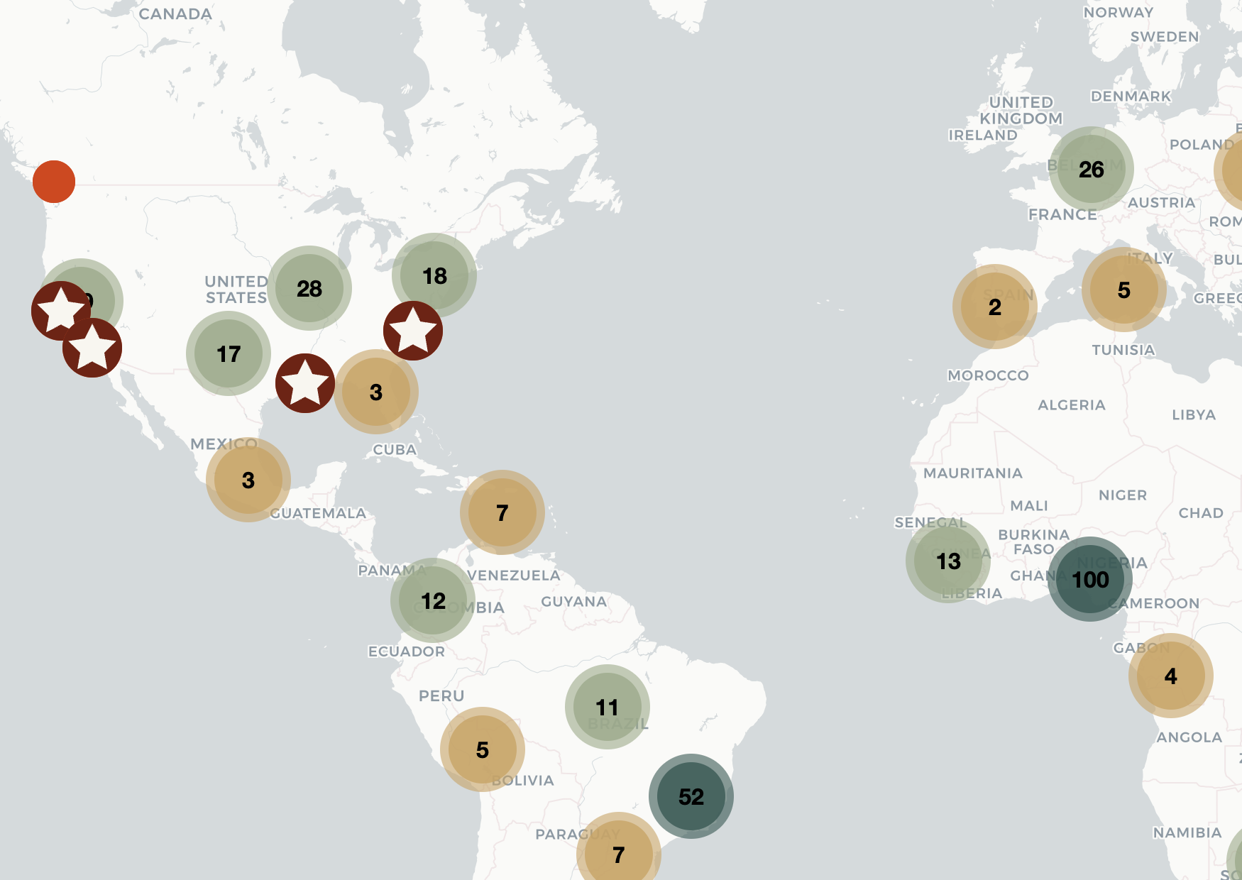
2025 Wilkes Prize Map
Interactive map displaying applicant locations from around the world for the 2025 Wilkes Center Climate Launch Prize.
View Tool